Rhode Island · Northeast
GIS Mapping Services in Rhode Island
Land survey CAD drafting services provider — 24–48 hr turnaround, drafted to your standards
We organize, convert and present your geospatial data in ArcGIS Pro and QGIS — from CAD-to-GIS conversion to publish-ready maps. Serving survey and engineering firms in Providence, Warwick, Cranston, Pawtucket.
24–48 hr turnaround NDA & secure uploads 10+ years drafting From $15/hr
GIS Mapping Services Services in Rhode Island
Parcel GIS Mapping — RIParcel fabric creation and maintenance.GIS Data Conversion — RICAD, PDF and paper maps to GIS layers.Shapefile & Geodatabase Creation — RIClean, attributed spatial datasets.Georeferencing — RIRaster and scanned map georeferencing.Utility GIS Mapping — RIUtility asset inventories in GIS.Zoning & Land Use Maps — RIMunicipal zoning and land-use mapping.Flood Zone Mapping — RIFEMA flood layer overlays and exhibits.Web GIS Maps — RIArcGIS Online and web map publishing.Thematic Mapping — RIPresentation-quality thematic maps.GIS Data Cleanup — RITopology, attribute and projection fixes.
Start a Rhode Island project
Other Services in Rhode Island
Land Surveying CAD Drafting in Rhode IslandLand Development CAD Drafting in Rhode IslandCivil Engineering Drafting in Rhode IslandCivil 3D Survey Drafting in Rhode IslandPoint Cloud & LiDAR to CAD in Rhode IslandSurvey Data Conversion in Rhode IslandAs-Built & Existing Conditions Drafting in Rhode Island
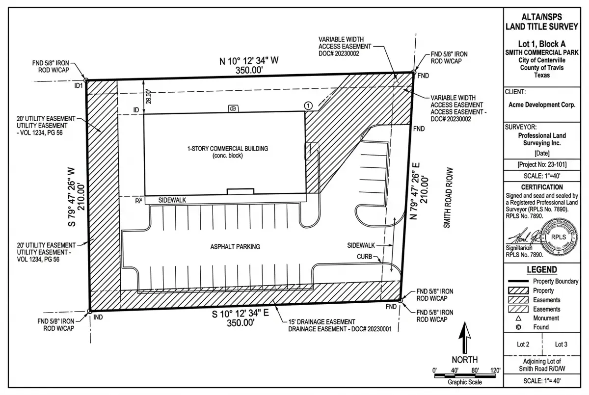
Representative Project
ALTA/NSPS Survey for a Retail Redevelopment
Delivered in 48 hours; the surveyor sealed after one minor revision.
Harris County, TX 4.6 acres 48 hours Civil 3D, Carlson
More USA projects GIS Mapping Services in Rhode Island — FAQ
GIS Mapping Services for Rhode Island firms
Free quote within 24 hours. Pay only for drafting hours used.