Mississippi · South
Point Cloud & LiDAR to CAD in Mississippi
Land survey CAD drafting services provider — 24–48 hr turnaround, drafted to your standards
Send LAS/LAZ/E57 or RCP data and receive accurate 2D linework, Civil 3D surfaces or 3D models extracted by experienced scan technicians. Serving survey and engineering firms in Jackson, Gulfport, Southaven, Hattiesburg.
24–48 hr turnaround NDA & secure uploads 10+ years drafting From $15/hr
Point Cloud & LiDAR to CAD Services in Mississippi
Terrestrial Scan to CAD — MSStatic scanner data to topo linework.Aerial LiDAR to CAD — MSAirborne LiDAR to surfaces and contours.Drone Photogrammetry to CAD — MSUAV orthomosaics and point clouds to CAD.Point Cloud to Topographic Survey — MSFull topo drafting from scans.Scan to BIM — MSRevit models from point clouds.Building Facade Drafting — MSElevations and facade details from scans.Bare-Earth Surface Extraction — MSGround classification and DTM creation.Point Cloud Classification — MSGround, vegetation and building classes.Mobile LiDAR Corridor Mapping — MSRoad and rail corridor extraction.Plant & Tank Scan Drafting — MSIndustrial scan-to-CAD drafting.
Start a Mississippi project
Mississippi Counties Covered
Point Cloud & LiDAR to CAD — Hinds CountyPoint Cloud & LiDAR to CAD — Harrison CountyPoint Cloud & LiDAR to CAD — DeSoto CountyPoint Cloud & LiDAR to CAD — Rankin CountyPoint Cloud & LiDAR to CAD — Jackson CountyPoint Cloud & LiDAR to CAD — Madison CountyPoint Cloud & LiDAR to CAD — Lee CountyPoint Cloud & LiDAR to CAD — Forrest CountyPoint Cloud & LiDAR to CAD — Lauderdale CountyPoint Cloud & LiDAR to CAD — Jones CountyPoint Cloud & LiDAR to CAD — Lamar CountyPoint Cloud & LiDAR to CAD — Lowndes CountyPoint Cloud & LiDAR to CAD — Lafayette CountyPoint Cloud & LiDAR to CAD — Oktibbeha CountyPoint Cloud & LiDAR to CAD — Washington County
Other Services in Mississippi
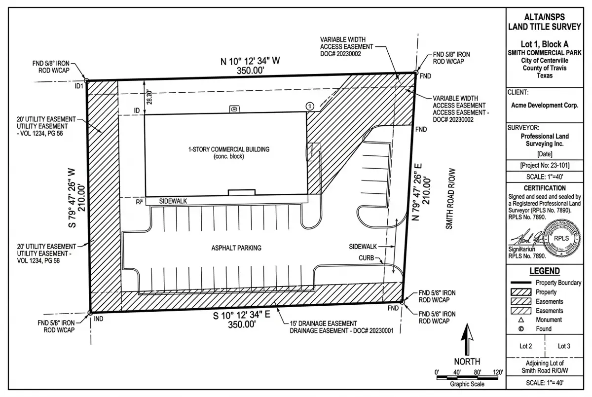
Representative Project
ALTA/NSPS Survey for a Retail Redevelopment
Delivered in 48 hours; the surveyor sealed after one minor revision.
Harris County, TX 4.6 acres 48 hours Civil 3D, Carlson
More USA projects Point Cloud & LiDAR to CAD in Mississippi — FAQ
Point Cloud & LiDAR to CAD for Mississippi firms
Free quote within 24 hours. Pay only for drafting hours used.