Connecticut · Northeast
GIS Mapping Services in Connecticut
Land survey CAD drafting services provider — 24–48 hr turnaround, drafted to your standards
We organize, convert and present your geospatial data in ArcGIS Pro and QGIS — from CAD-to-GIS conversion to publish-ready maps. Serving survey and engineering firms in Bridgeport, New Haven, Hartford, Stamford.
24–48 hr turnaround NDA & secure uploads 10+ years drafting From $15/hr
GIS Mapping Services Services in Connecticut
Parcel GIS Mapping — CTParcel fabric creation and maintenance.GIS Data Conversion — CTCAD, PDF and paper maps to GIS layers.Shapefile & Geodatabase Creation — CTClean, attributed spatial datasets.Georeferencing — CTRaster and scanned map georeferencing.Utility GIS Mapping — CTUtility asset inventories in GIS.Zoning & Land Use Maps — CTMunicipal zoning and land-use mapping.Flood Zone Mapping — CTFEMA flood layer overlays and exhibits.Web GIS Maps — CTArcGIS Online and web map publishing.Thematic Mapping — CTPresentation-quality thematic maps.GIS Data Cleanup — CTTopology, attribute and projection fixes.
Start a Connecticut project
Connecticut Counties Covered
GIS Mapping Services — Fairfield CountyGIS Mapping Services — Hartford CountyGIS Mapping Services — New Haven CountyGIS Mapping Services — Litchfield CountyGIS Mapping Services — Middlesex CountyGIS Mapping Services — New London CountyGIS Mapping Services — Tolland CountyGIS Mapping Services — Windham County
Other Services in Connecticut
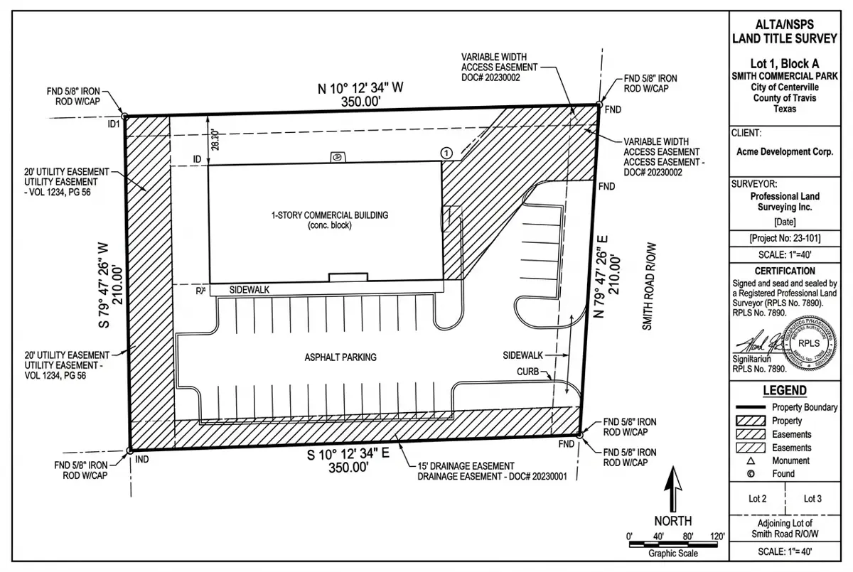
Representative Project
ALTA/NSPS Survey for a Retail Redevelopment
Delivered in 48 hours; the surveyor sealed after one minor revision.
Harris County, TX 4.6 acres 48 hours Civil 3D, Carlson
More USA projects GIS Mapping Services in Connecticut — FAQ
GIS Mapping Services for Connecticut firms
Free quote within 24 hours. Pay only for drafting hours used.